
https://z5h64q92x9.net/proxy_u/ru-en.en/lostarmour.info/articles/topornaya-rabota/
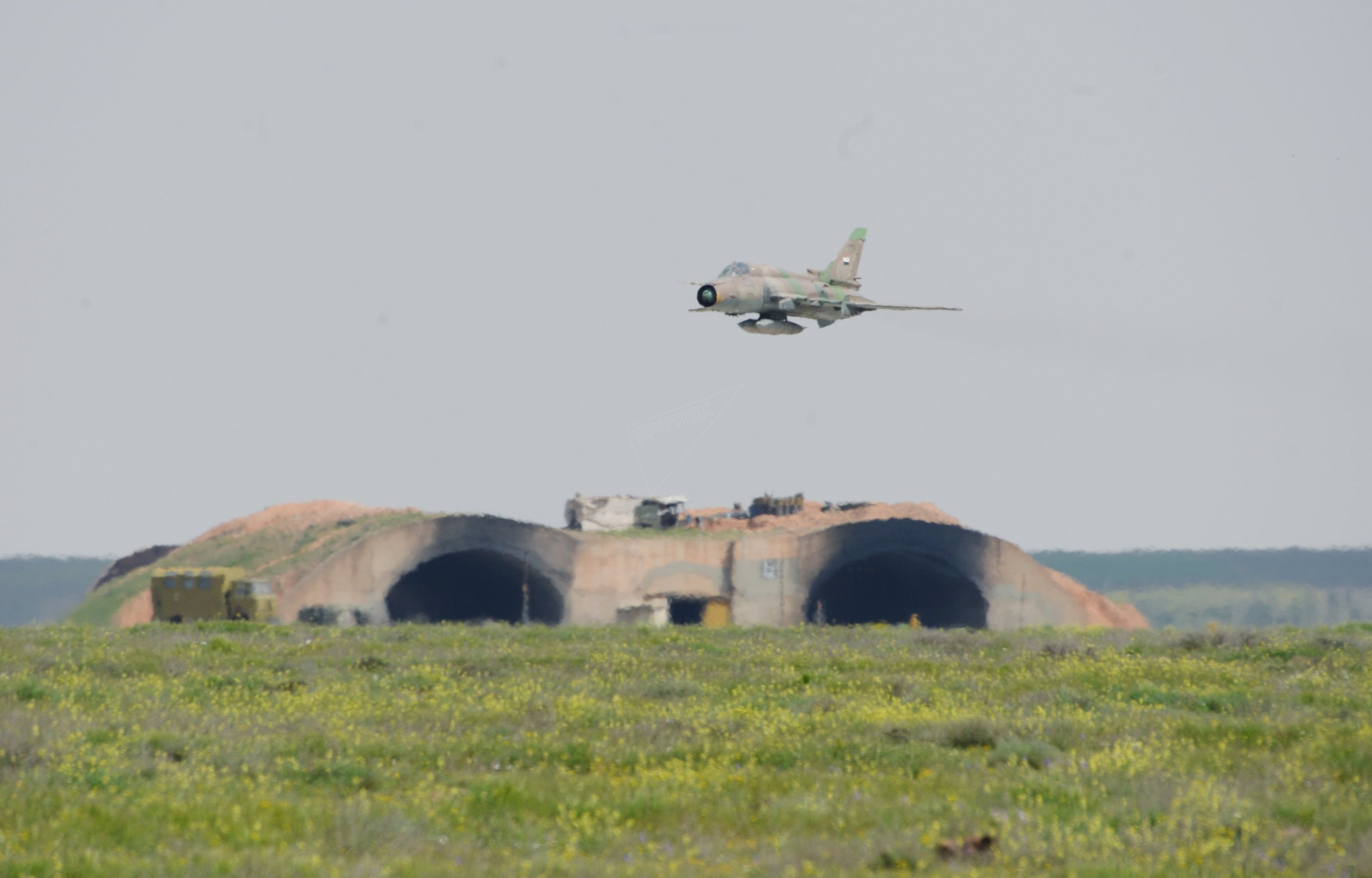
April 7 at 1:40 UTC (4:40 local time), the United States launched a missile attack on air base al-Sirat . The attack was carried out in response to the chemical attack that took place on 4 April in the city of Khan Sheikhoun that resulted in large civilian casualties, the responsibility for which, without any international investigation, it was hastily imposed on the government forces of Syria. A missile attack was caused by two destroyers of the U.S. Navy: USS Ross (DDG-71) and USS Porter (DDG-78) from the Mediterranean sea, 60-d missiles “Tomahawk”(press release of the Pentagon ).
The attack generated a large number of various arguments and statements concerning its effectiveness and efficiency, this article is an attempt to summarize the available photos, videos, satellite images, attach them to the map, to assess the damage to infrastructure, to count the number of destroyed aircraft and the flow rate CU.
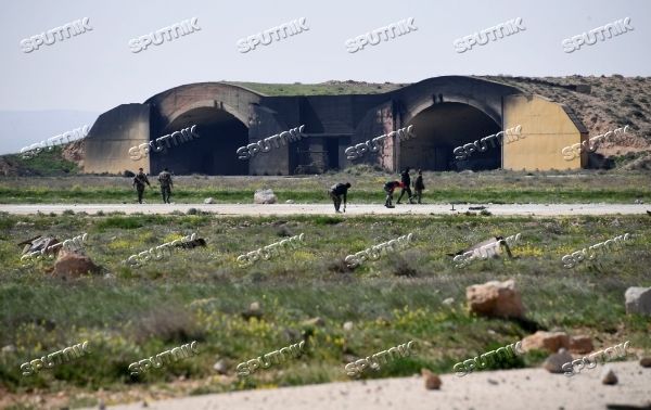
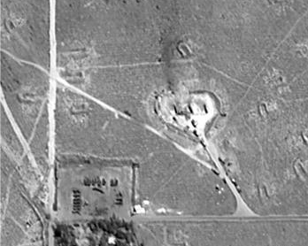
General view of AB El-Sirat, the numbering of IBU (concrete shelter) goes clockwise starting from the North-Eastern part of the base:
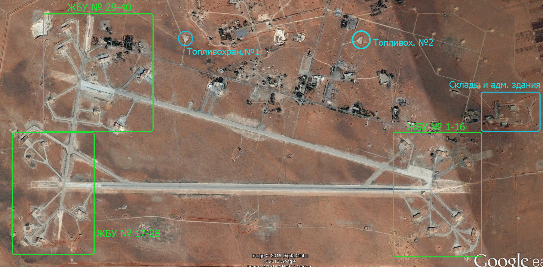
IBU with 1-2 15-16 General appearance:

A satellite image of the General view after the impact, JBU with 3-4 15-16:

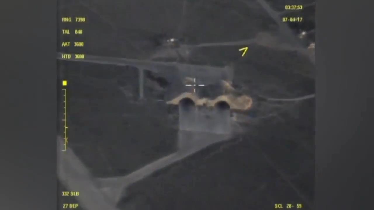
IBU, No. 1-2 http://wikimapia.org/#lang=ru&lat=34.488861&lon=36.923093&z=18&m=b:
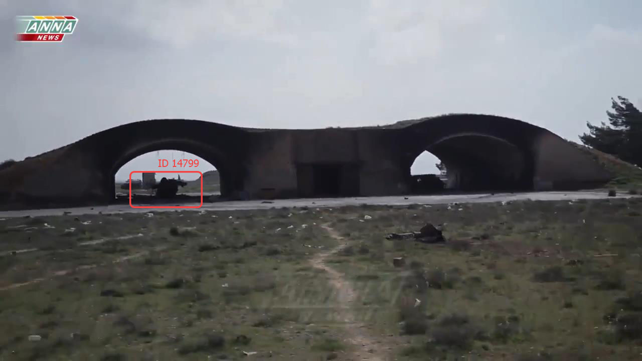
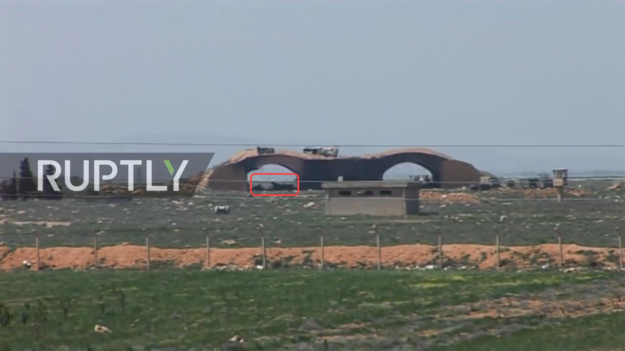
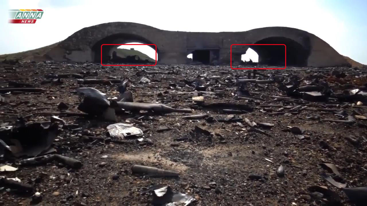
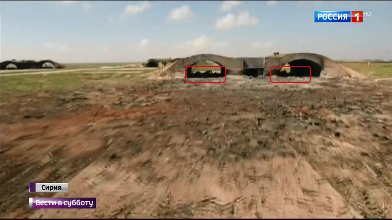
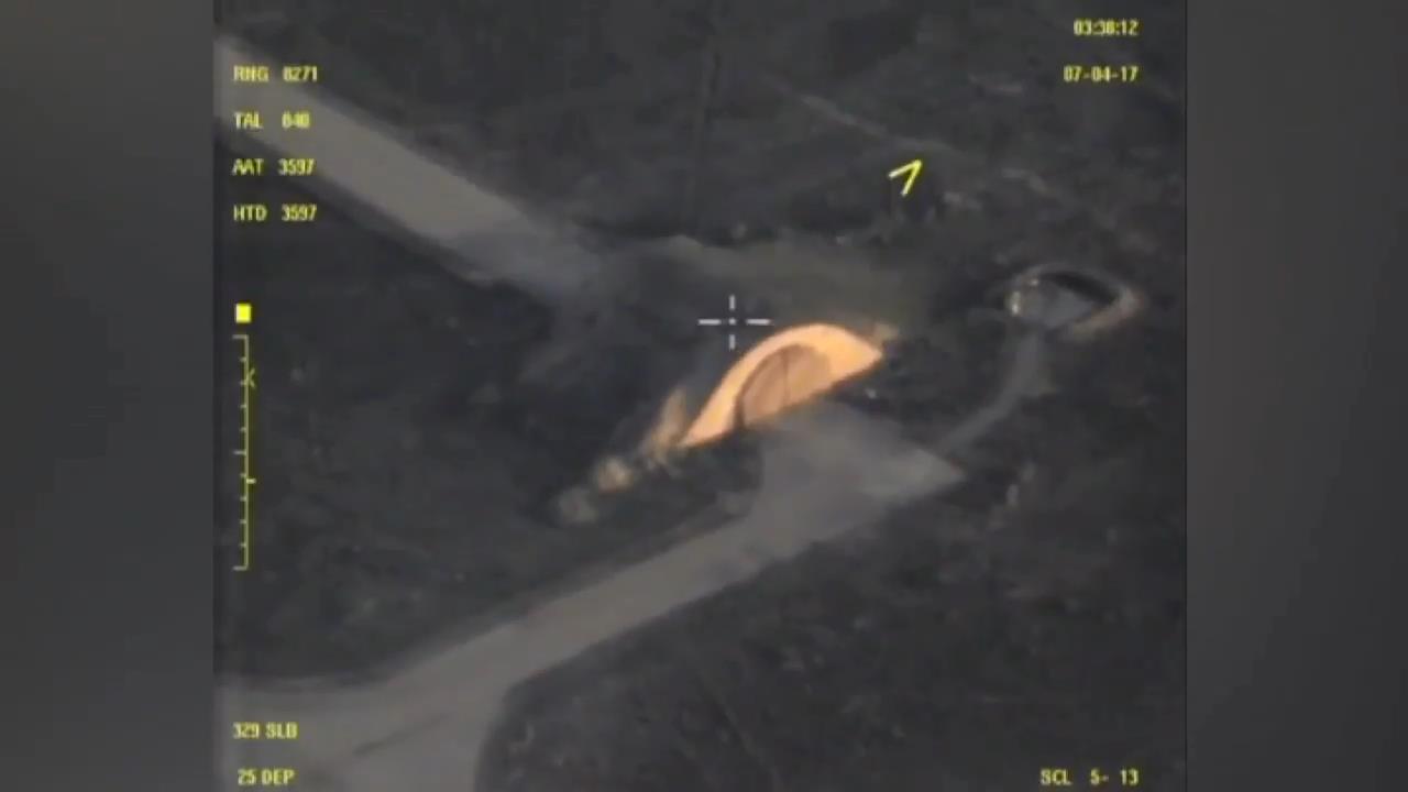
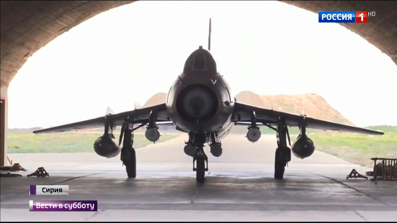
The surviving MiG 23 in the arched shelter No. 1:

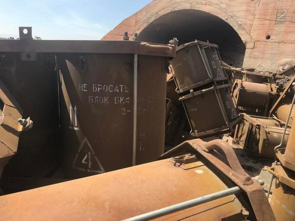
Destroyed 1 arched cover,1 MiG 23, one 1 MiG 23 survived, the consumption of 1 CU Tomahawk.
IBU, No. 3-4 http://wikimapia.org/#lang=ru&lat=34.487267&lon=36.925778&z=18&m=b:

Destroyed: 2 arched cover, 2 MiG 23, flow 2 CU Tomahawk.
IBU, No. 5-6 http://wikimapia.org/#lang=ru&lat=34.486058&lon=36.927706&z=17&m=b:
Left in the arched shelter No. 6 can be seen the remains, with high probability, the remains of LA, MiG 23.
Destroyed: 2 arched cover, LA may 1, MiG 23, flow 2 CU Tomahawk.
Panoramas on JBU No. 7-8, No. 11-12
(JBU No. 7-8 http://wikimapia.org/#lang=ru&lat=34.482518&lon=36.925172&z=18&m=b
No. 9-10 http://wikimapia.org/#lang=ru&lat=34.481068&lon=36.925961&z=18&m=b
No. 11-12 http://wikimapia.org/#lang=ru&lat=34.480343&lon=36.924105&z=18&m=b)
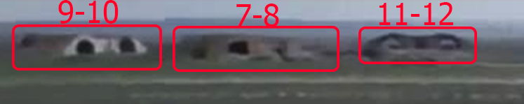
Strong approximation, so the resolution is very bad, but on screen it is possible to distinguish between intact, IBU 7-8 (in recent times at this shelter for some reason, it was demolished right, the 8th arched shelter)
( the picture is from 2017. 02.18)
IBU, No. 9-10 is seen burning in the right, the 10th arched shelter, but most likely affected the left and the 9th.
IBU, No. 11-12 impressed by both the arched cover, some visible remains of both caponiers, most likely LA,MiG 23.
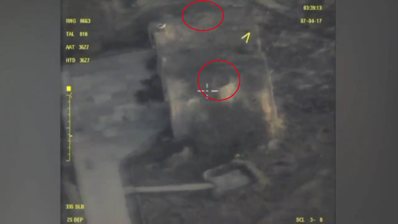
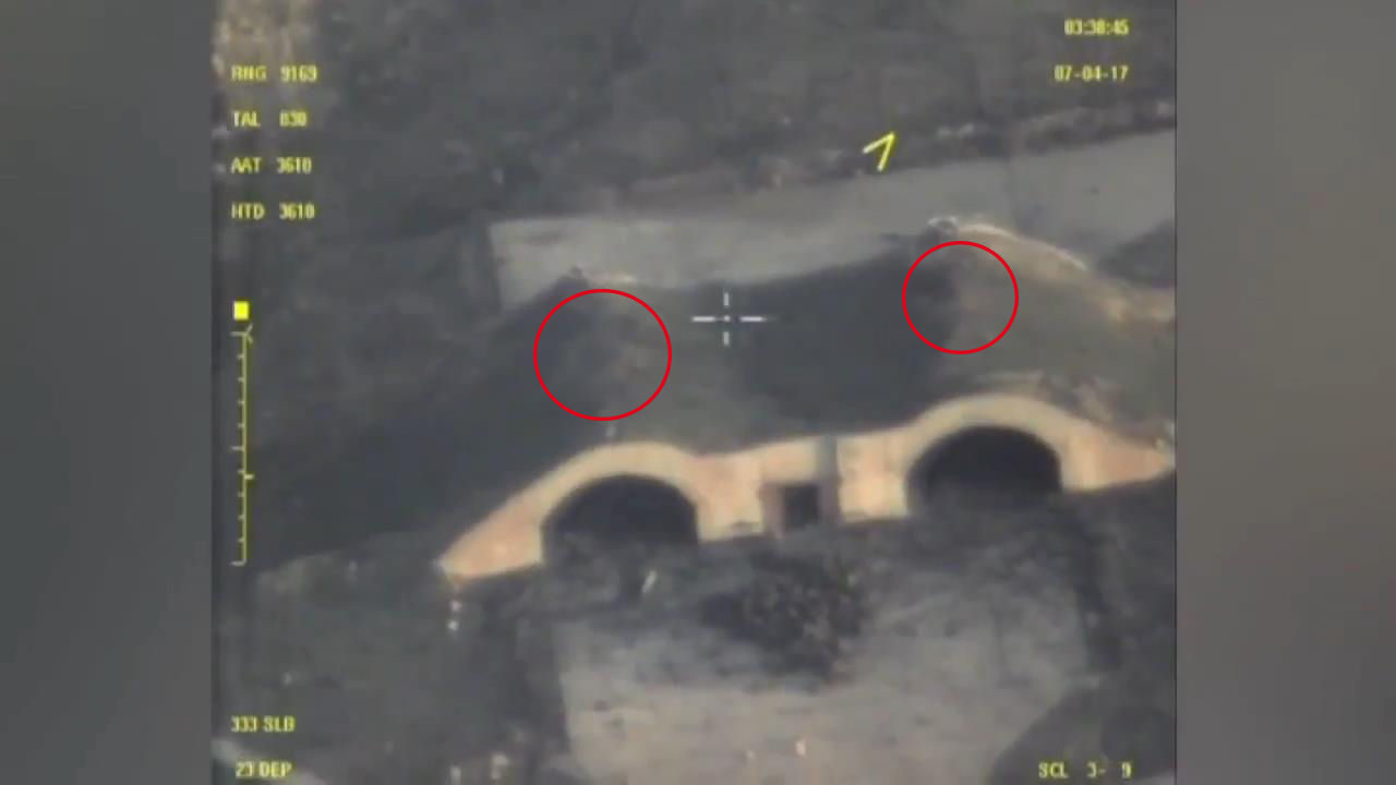
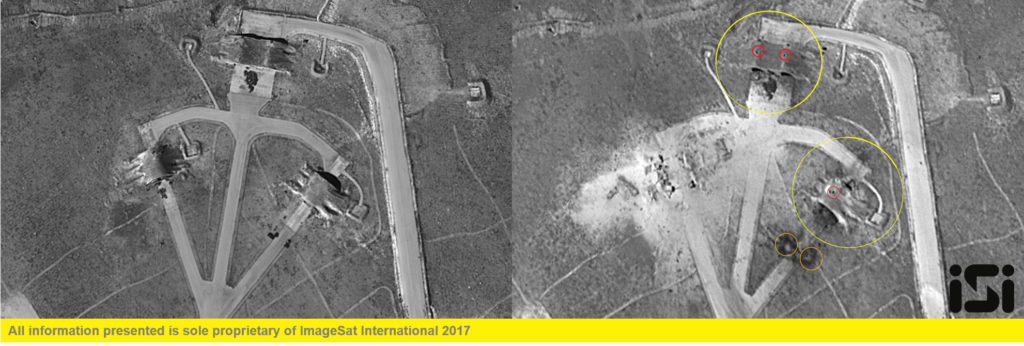
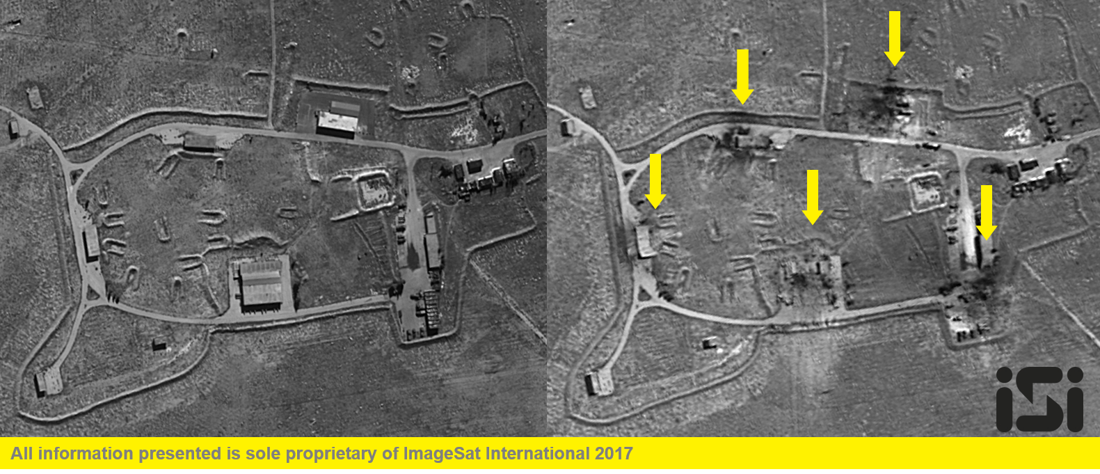
These estimates correlate well with common satellite imagery after stroke:
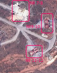
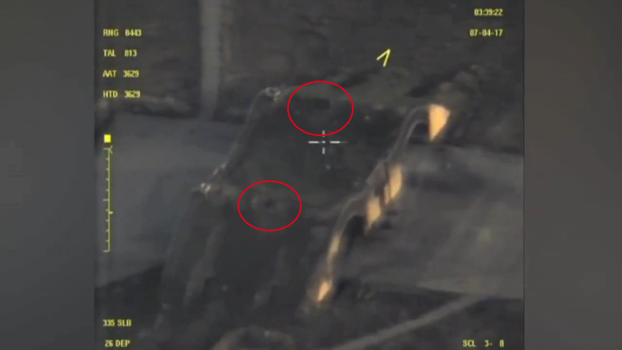
(Red circles marked hypothetical places the arrival of the CD)
Destroyed: 3-4 arched shelter, are visible the remains of a 2-caponiers may LA, 2 MiG 23, consumption 3-4 CU Tomahawk.
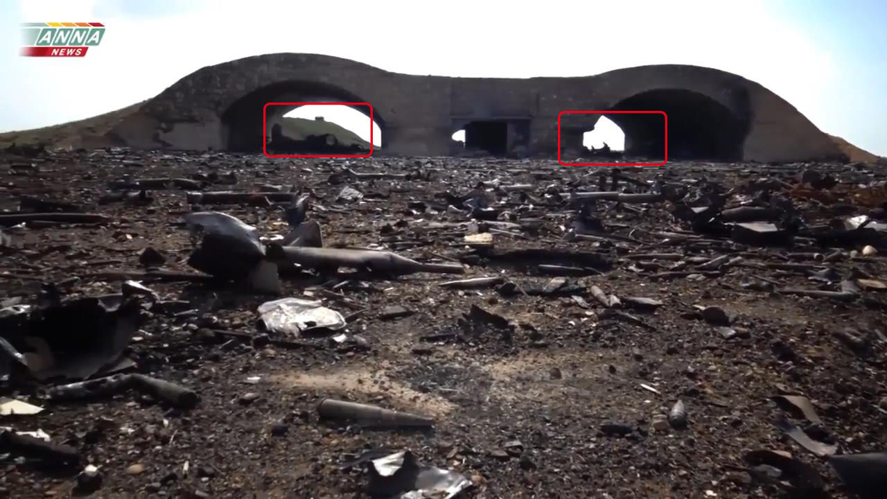
View of JBU No. 13-14 (http://wikimapia.org/#lang=ru&lat=34.482222&lon=36.922624&z=18&m=b) No. 15-16 ( http://wikimapia.org/#lang=ru&lat=34.483557&lon=36.921803&z=18&m=b ):

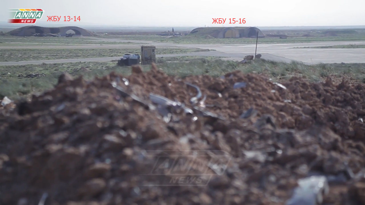
EBU 13-14 – there is a burning of the 13th, left the arched shelter, right 14th seems intact, but the satellite picture shows his defeat, may not have been break-through, estimate according to the available photo is not possible.
IBU, 15-16, left, 15, of arch cover are intact, no signs of burning and damage, right, 16, amazed.

(Red circles marked hypothetical places the arrival of the CD)
Destroyed: 2-3 arched shelters, consumption of 3 CU Tomahawk.
General view of JBU No. 17-18 at No. 28:
A satellite image of the General view after the impact, JBU No. 17-18 at No. 28:

IBU, No. 17-18 http://wikimapia.org/#lang=ru&lat=34.492454&lon=36.893908&z=18&m=b:
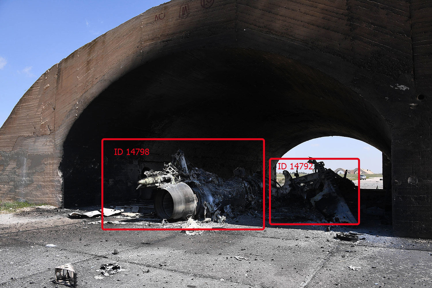

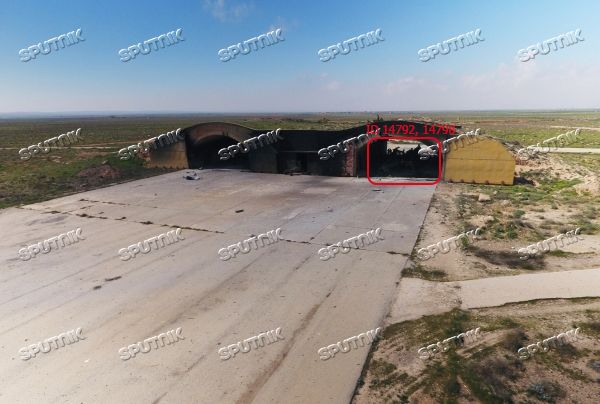
Destroyed: 2 arched shelter, in shelter No. 18 destroyed 2 su 22 ID 14792 , 14798, flow 2 CU Tomahawk.
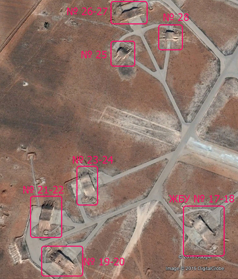
View of JBU No. 19-20, No. 23-24
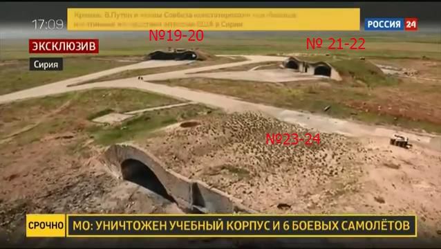
IBU, No. 19-20 ( http:// wikimapia.org/#lat=34.4915829&lon=36.8896913&z=19&l=1&m=b )

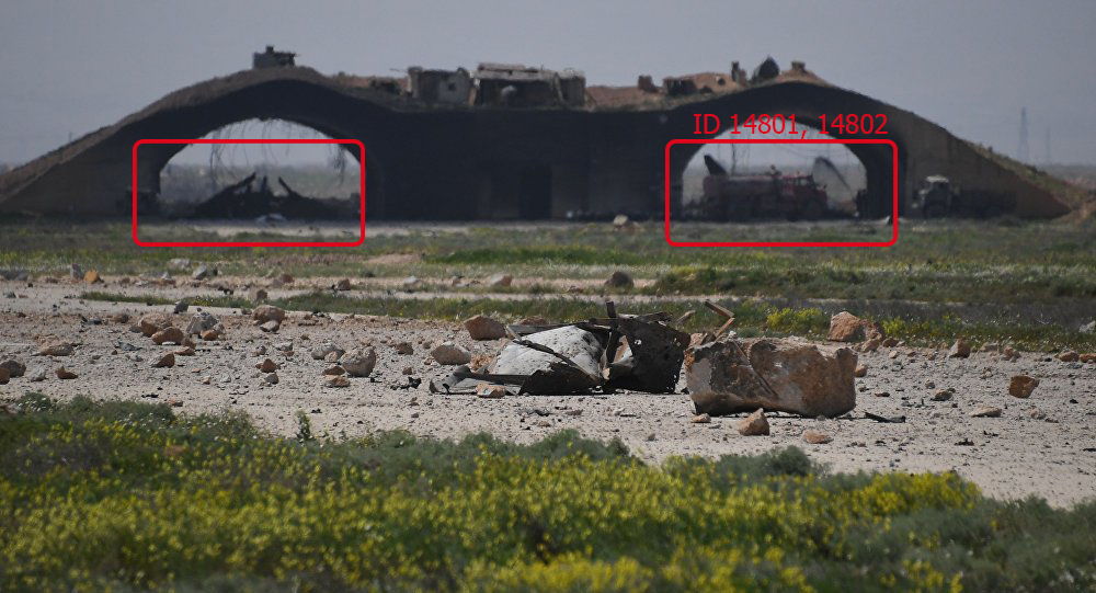

Destroyed: 2 arched cover, 3 su-22 ID 14801, 14802 consumption 2 CU Tomahawk.
IBU, No. 21-22 (http://wikimapia.org/#lat=34.4927833&lon=36.8891093&z=18&l=1&m=b)

(The growth of the parish CU)
Destroyed: 2 arched cover, 2 su-22 ID 14819, 14820, flow 2 CU Tomahawk.
IBU, No. 23-24 (http://wikimapia.org/#lang=ru&lat=34.493630&lon=36.890223&z=18&m=b)

(The growth of the parish CU)
Destroyed 2 arched shelter, are visible the remains of two AIRCRAFT, probably 2 su-22, consumption Tomahawk 2 CU +1 CU, possible air burst in front of IBU.
View of JBU No. 25 No. 28:

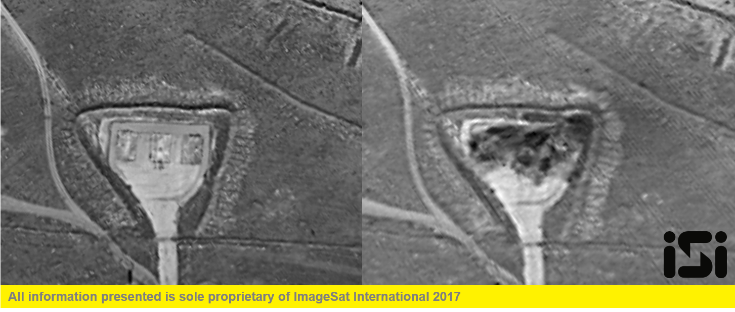
IBU, No. 25 ( http://wikimapia.org/#lang=ru&lat=34.497680&lon=36.891103&z=17&m=b):

GBU destroyed at the base, apparently the shelter was filled up to the top of BP, a minimum flow of 1 CU Tomahawk.
IBU, No. 26-27 (http://wikimapia.org/#lang=ru&lat=34.498997&lon=36.891392&z=17&m=b):
(Marked presumable places of coming CD)


Despite the presence of craters on the roof of EBU visible signs of damage and burning in both arched shelters there, apart from a few prudkov iron fittings hanging from the roof, most likely breaking it was not, flow 2 CU Tomahawk.
IBU, No. 28 (http://wikimapia.org/#lang=ru&lat=34.498997&lon=36.891392&z=17&m=b)

GBU destroyed before caponier on the steering strip there are traces of explosions, likely secondary detonation stockpiled there BP on satellite images “To” boxes present another version of the air explosion. Consumption 1-3 CU Tomahawk.
General view of the intact, JBU No. 29 No. 39-40:
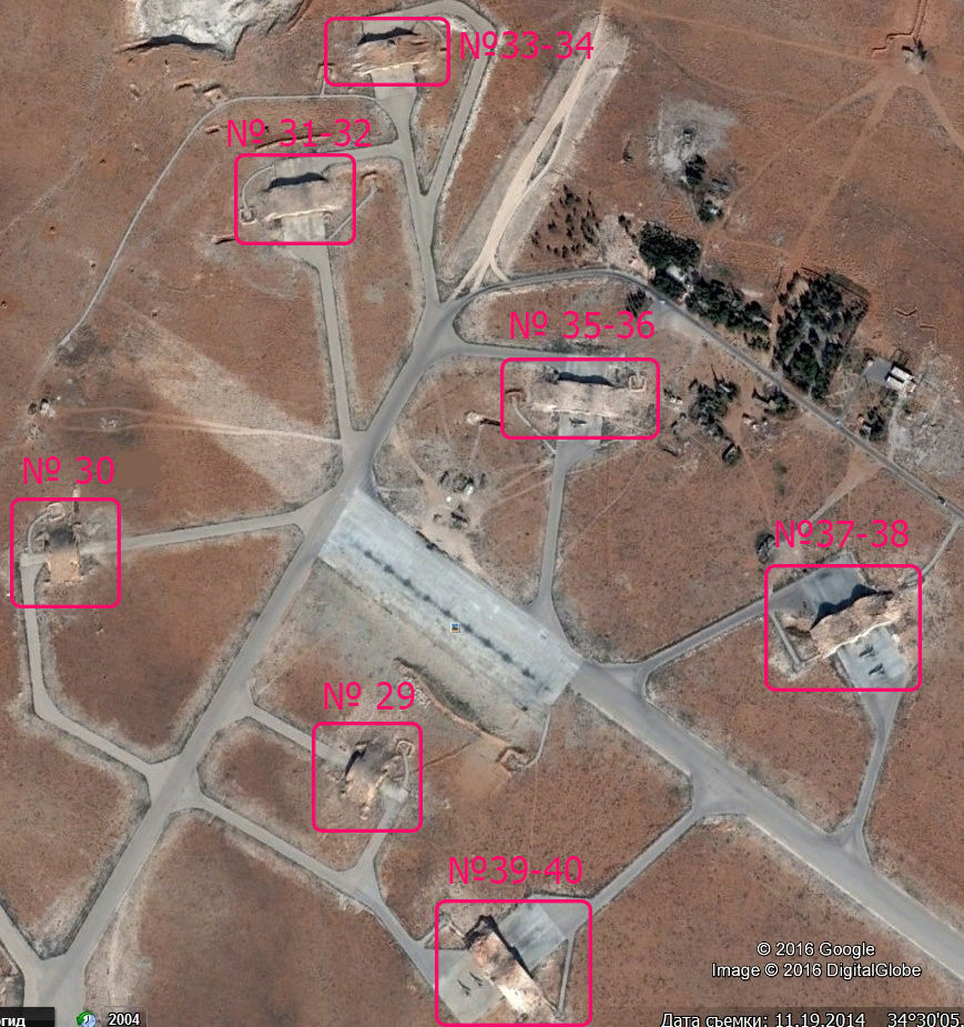
(The numbering of data, GBW may be incorrect).
The panorama of the intact IBU, No. 29, No. 33-34, No. 29-40:
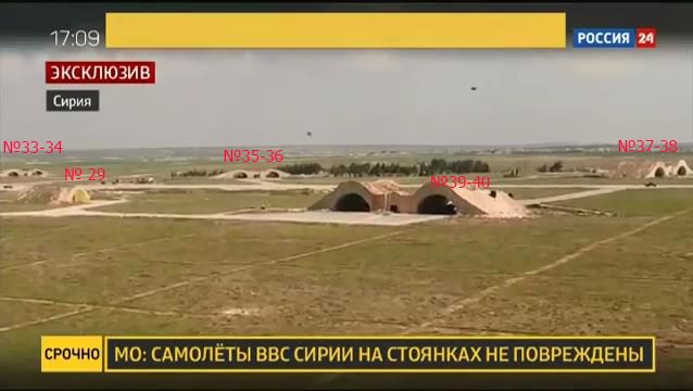
IBU, No. 29 (http://wikimapia.org/#lang=ru&lat=34.499077&lon=36.898205&z=18&m=b):
IBU, No. 31-32 (http://wikimapia.org/#lang=ru&lat=34.504399&lon=36.897197&z=18&m=b):


IBU, No. 35-36 (http://wikimapia.org/#lang=ru&lat=34.502454&lon=36.900501&z=18&m=b):
(in the background, JBU No. 39-40)

IBU, No. 29-40 (http://wikimapia.org/#lang=ru&lat=34.497410&lon=36.899723&z=18&m=b):

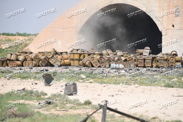
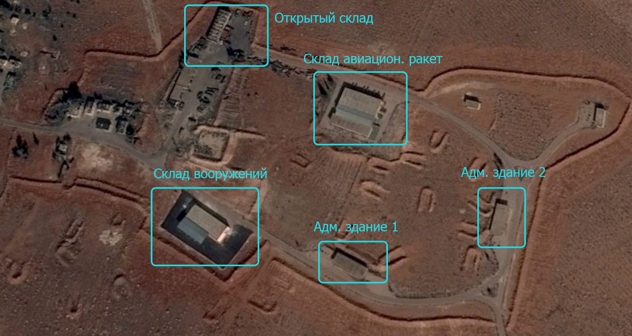
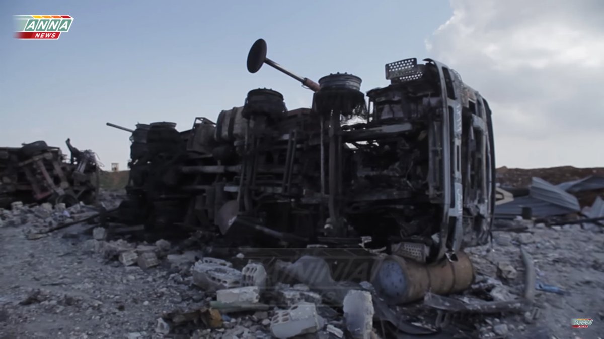
General view of the destroyed warehouses and administrative buildings, consumption of 5-6 CU Tomahawk (http://wikimapia.org/#lang=ru&lat=34.488147&lon=36.933460&z=17&m=b):

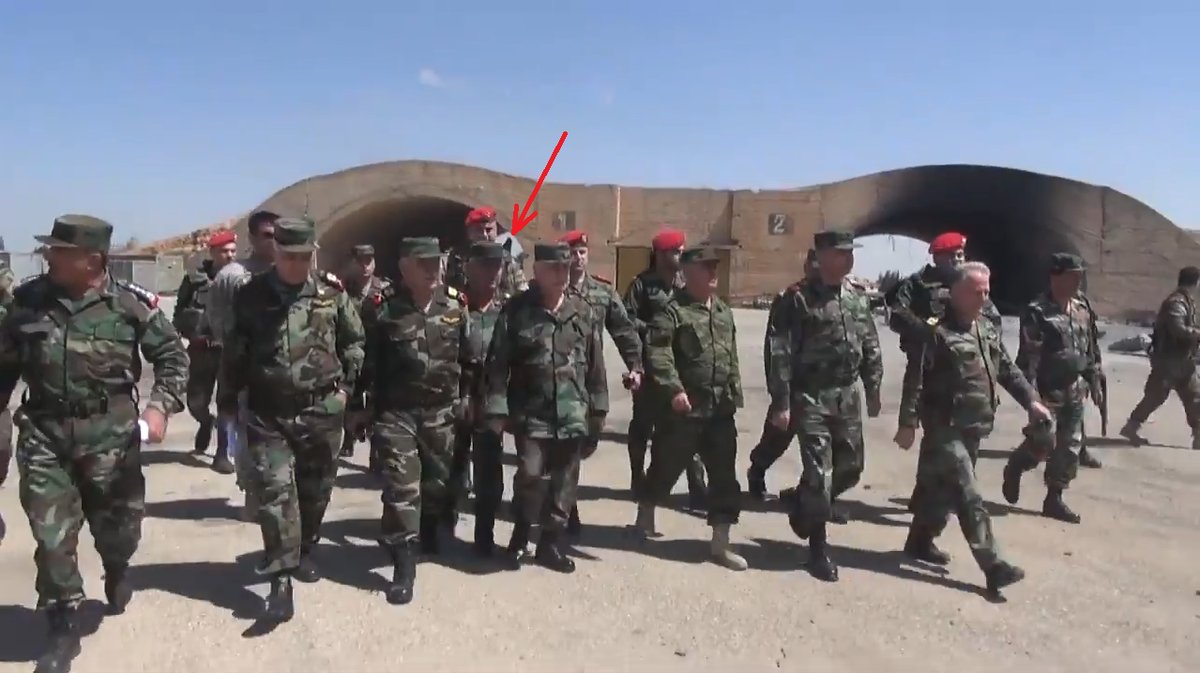
Reporting Anna from the warehouse district from 3:20 https://www.youtube.com/watch?v=W2s_aD3D3QE
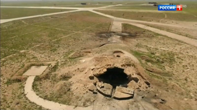
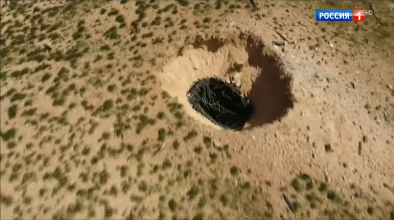
Destroyed the fuel storage, No. 1 (http://wikimapia.org/#lang=ru&lat=34.501941&lon=36.908076&z=18&m=b):
A minimum flow of 1 CU Tomahawk.
the fuel depot No. 2 (http://wikimapia.org/#lang=ru&lat=34.497220&lon=36.922817&z=18&m=b):
A minimum flow of 1 CU Tomahawk.
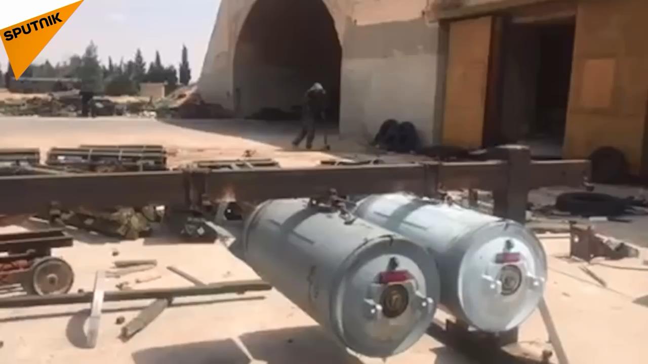
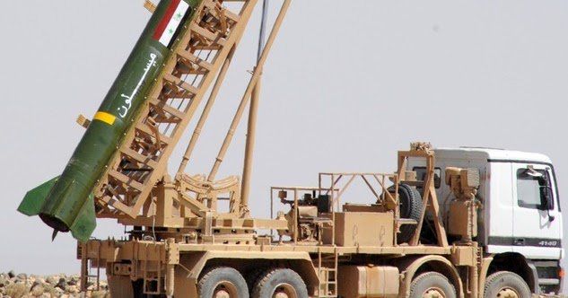
Destroyed self-propelled missile launchers tactical missiles Fateh M600:
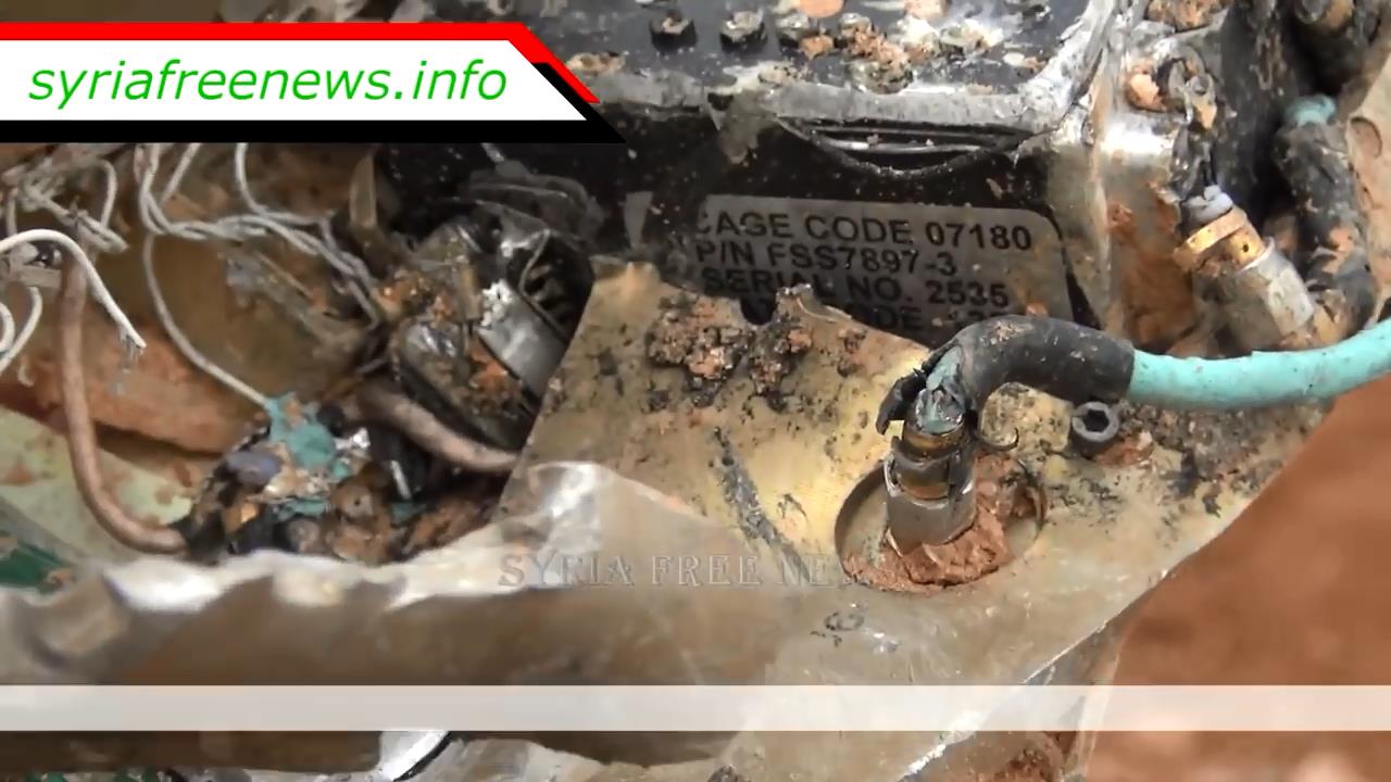
Not spent CU Tomahawk:
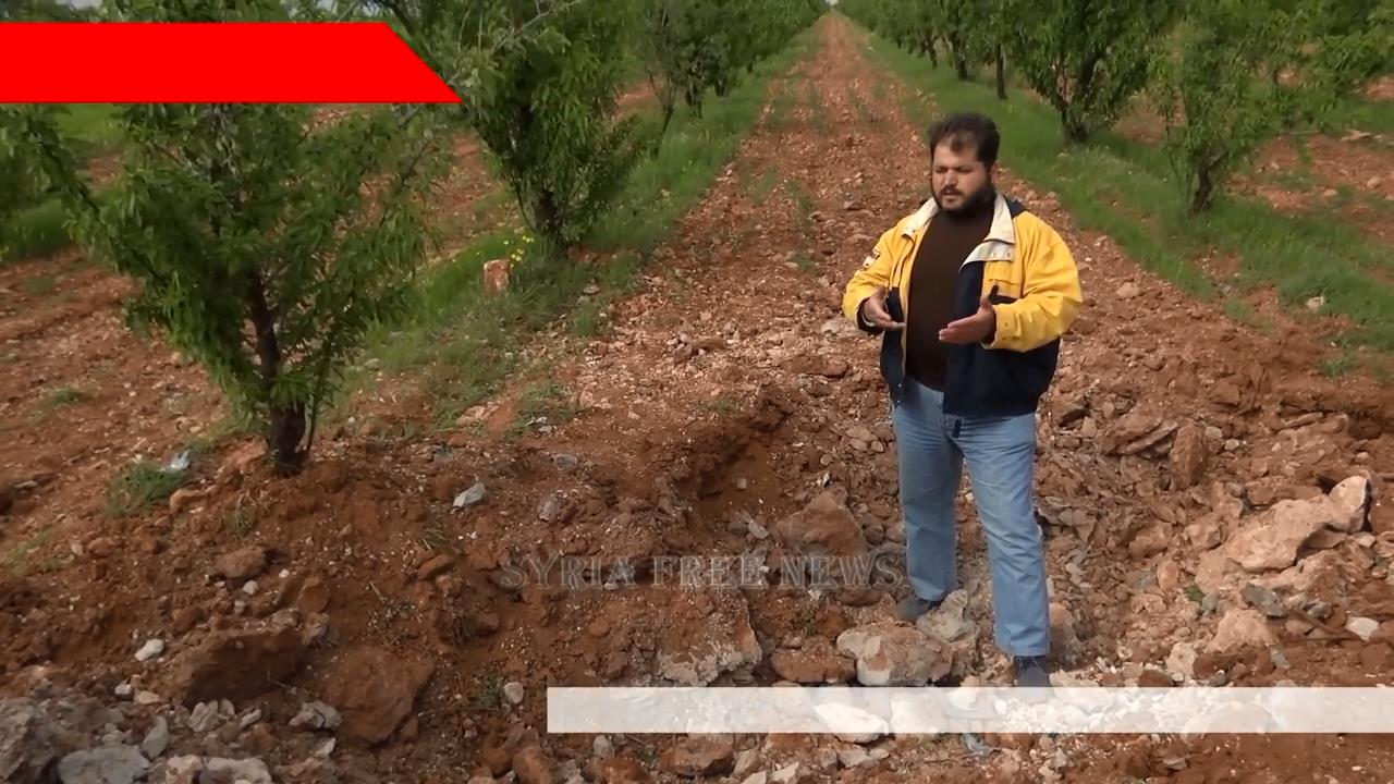
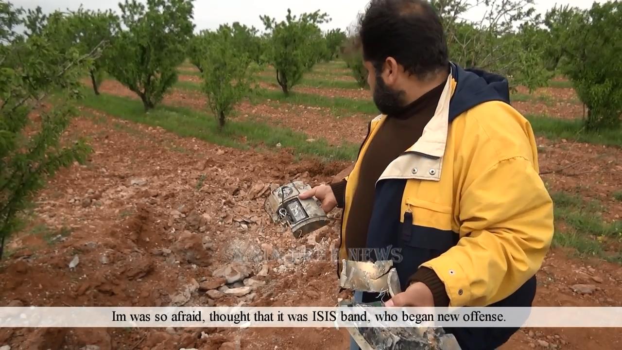
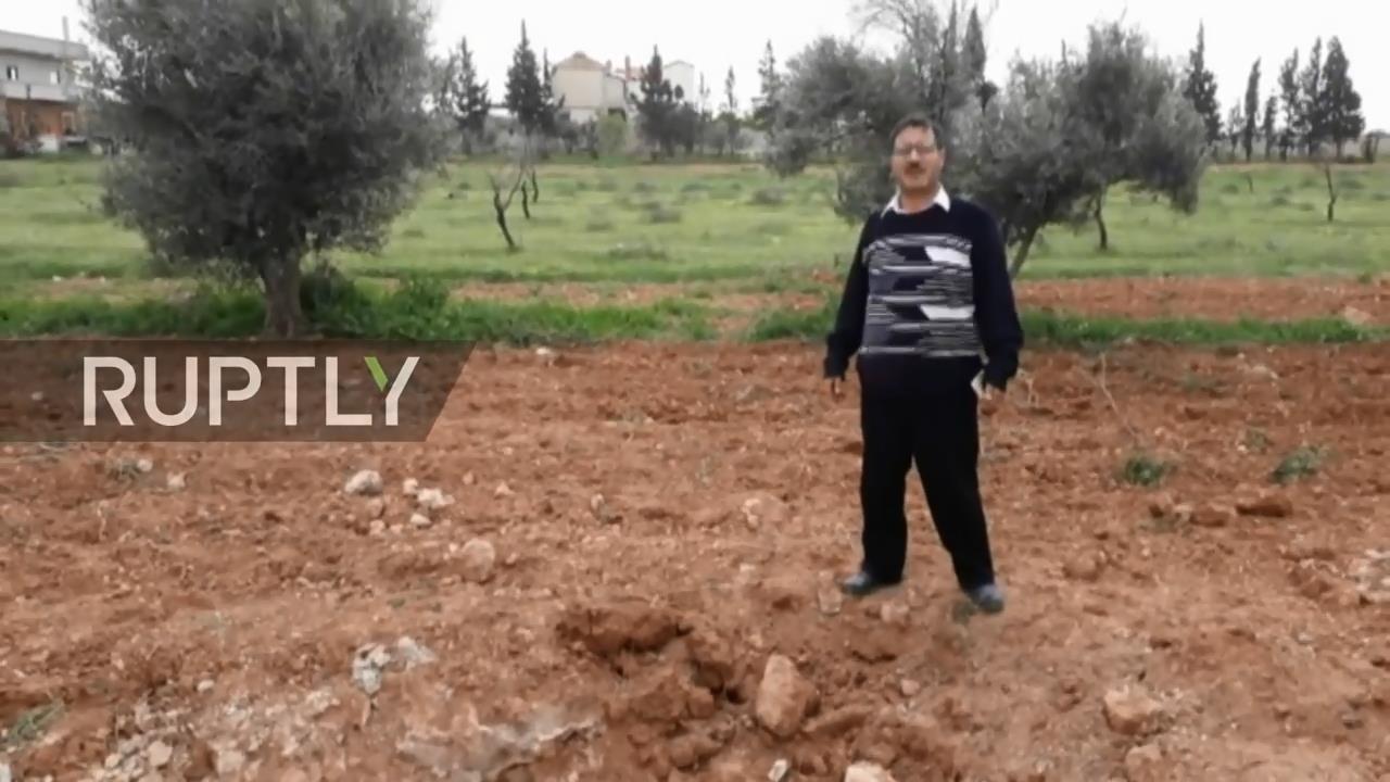
No. 1 in the outskirts of Tartus:


No. 2 Farm close AB:
https://www.youtube.com/watch?v=SmFKNFMKOis
No. 3 The Village Of Al-Sirat:
https://www.youtube.com/watch?v=aOMJEYifdks
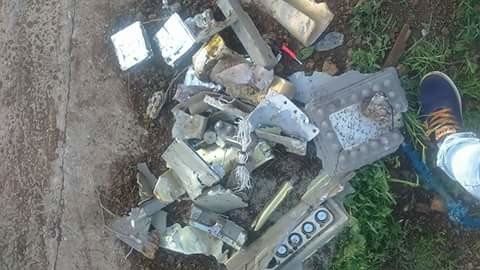
No. 4 According to media reports one CU Tomahawk did not work at startup:
http://www.rbc.ru/rbcfreenews/58e7a5179a7947075a794739?
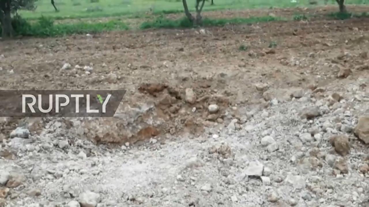
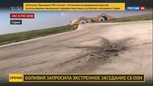
Damage to runways, which is difficult to identify what it could be:
No. 1 http://wikimapia.org/#lang=ru&lat=34.493758&lon=36.895874&z=19&m=b :

No. 2 http://wikimapia.org/#lang=ru&lat=34.497706&lon=36.894268&z=18&m=b :

Total of what is known and what can be bound, destroyed 12-15 LA: 3-6 MiG 23, su 22 9, the minimum flow rate of 30-35 CU Tomahawk.
Confirmed surviving LA 4 : 1 MiG 23, su 22 3.
PS the Article was written using information site http://lostarmour.info and forum Waroffline ( http://waroffline.org/index.php?showtopic=830&st=0 (special thanks to party pfc_joker).
